paul3f
1

"the longitudes..."
Hello,
thanks for the pictures, and the report, the book you photographed is the manual (from 1775) of the “GPS” you are referring to a bit later in your report, the page you pictured says :
Longitudes by
the measurement of time,
or method to determine longitudes at sea, with the help of marine clocks.
Followed by the collection of the tables useful to the pilot to reduce (use? conclude from ?) the observations relating to longitude and the latitude.
By Mr. Ferdinand Berthoud, mechanic clockmaker of the King
and of the Marine, in charge of the inspection of the construction of the marine Clocks, and member of the Royal Society of London.
Best
Chopard Manufacture Visit Part 2(c)-Time Travel with L.U.CEUM
Please click here to access Part 2(b) Visit to FQF Previously we were at the Fleurier Quality Foundation (FQF) to see how the Fleuritest was performed. The next venue was the L.U.C museum. It was 3:55 pm when we left FQF. Got to rush back to Chopard Manuf...


"the longitudes..."
Hello, thanks for the pictures, and the report, the book you photographed is the manual (from 1775) of the “GPS” you are referring to a bit later in your report, the page you pictured says : Longitudes by the measurement of time, or method to determine lo...
Thanks Paul3f for the translation...
if revisiting again, will try to ask to look at the book contents (I mean pictures ) . The Berthouds were exceptional in watch-making, as the L.U.CEUM consists a few of their pieces. Kong

Thanks for the report!
The Luceum looks like a great visit. I only wish they had more of the movements visable. There's got to be a way to show off the dial, back case and movement, all at once.... A
I guess if have sufficient time, or just purposedly visit the L.U.CEUM ...
may be able to request to see the pieces (out from the cases) with the curator , Ms. Anne Walther. If you can get/borrow a copy of the L.U.CEUM book, there are many nice pictures. If can fabricate a rotatable glass case ( with non-reflective glasses), it ...

I really like your posts Kong, they're always informative...
...still waiting for Bvlgari novelties from Baselworld by the way Thanks,
Kong, the collection in L.U.CEUM is an eye opener
Hey, they have fusee and chain. I particularly like the gold pocket watch with planetarium (blue enamel dial). The unanswered question may be able to find an answer. My guess is that the 2 identical pocket watches is either for the richman's twins daugthe...

One day at a time......
One rumour is that they already had long servicing periods in the 19th century (like today). It was worse because they did not have Fedex or DHL and the round trip back to factory could take years. So, one had 2 watches to allow for one to always be in us...
Very expensive way to solve long turn around time.
May I suggest that for services that will last for more than 3 months (duration is negotiable), Chopard is to provide another similar watch for temporary use to the customer. Upon return of the serviced watch, the customer has an option to either return t...
Mystery Missing....
Ling, This suggestion was tried by A Lange & Sohne. They made stainless steel versions of their early watches in 1994-5 as loaners during servicing. Mysteriously, when the owners' watches were ready, the loaners were conveniently (or inconveniently fo...
Indeed eye-opener, just need more time!
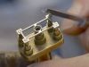
There are many ancient horological pieces in the L.U.CEUM ! The work of the past geniuses had yet to be surpassed till now. With just simple tools, raw metals and no CAD, they created stunning pieces. I'm just short of holding and viewing them on my hands...
Is it fair too say that ...
in old days, the master watchmakers are generally more skillful as they managed to produced so many complicated and nice pieces with such limitations? In terms of labour cost, they should charge much much more than what today's watchmakers have been charg...
Ling, I second you
I think in the good old days, a watch is much more a "tool" therefore the price commensurate with the functions, complextity, workmanship, etc. Nowadays, since a watch is no longer a "neccessity" in all practical sense, it all boils down to "luxury" brand...


Chopard made very beautiful pocket watches!
Kong, many thanks for this great post again, I am not aware that Chopard had made so beautiful pocket watches until reading your post which is eye-openning to me. best, stefan
Chopard's origin is watchmaking...
Hi Stefan Mr.Karl-Friedrich Scheufele has started the back-to-root journey through L.U.C since the past 14 years. I wonder if next year 150th Anniversary, would there be a Chopard pocket-watch? It should be interesting. Thanks for reading. Kong

Thanks for the great report and look in the L.U.CEUM. The photograph
from the entrance, with all the wood beams and the displays is something out of a dream. This place is on my list for a must visit. You gave a really great sense of being there, key to any great report. Best, Tim
Thanks Tim...
for the kind words. Yes, it is a must visit. Reason is the collection is still growing and not collected base on a single brand, instead likely by the innovation in every individual pieces. Kong
Welcome Watchuknow ...
to the Chopard forum. Many of us like the enameled pieces. Thanks for the kind words. Kong

Great description and photos.
Wish I could be there! Thank you for all the four parts, Kong!